About Speakers
Holding a Bachelor's Degree in Computing & Cartography from Oxford and a Master's Degree in Surveying from UCL, Julian started his career in the oil & gas industry as an industrial plant surveyor. Julian worked at Leica Geosystems where he held positions in sales, product management and business development, advancing laser scanning commercially and technically. Julian is now working for Pix4D in Switzerland as Business Development Manager for construction.
Abstract: Jobsites of the Future: Drones, Real-time Mapping, Cloud and Machine-Learning Better site monitoring. Increased efficiency. Exceptional precision. It's no secret that drones have changed the way that construction sites operate. UAVs are quickly becoming the go-to tool for gathering measurement data and as-built updates, increasing efficiency in the field and enabling smarter project management decisions. How drone mapping has transformed construction jobsites into vibrant digital workspaces, how is it used not only for planning and scheduling but also for earthwork management and site surveys? In this presentation, we will go beyond data collection and see how drones, crane cameras, and photogrammetry are shaking up the AEC industry and its processes by providing never before possible, daily measurable 2D/3D models of the as-built, on an ever-ongoing process, integrating cloud technology for better collaboration. We'll understand how this can drive efficiencies, savings and foster a valuable VDC/BIM process helping to keep a site on design and on schedule. And we won't stop there. We'll finally see how drone-captured imagery and machine-learning photogrammetry processes can be used to automate object recognition and 3D modeling, producing intelligent as-built data for BIM integration.

Rob van de Velde is director of Geonovum, the Dutch National SDI Executive Committee. Making the Government work smarter when it comes to location, is the common thread in his work in the public sector. Graduated as a human geographer, he started his career in geospatial technology when joining the National Planning Agency in 1985, the first Governmental Agency in the Netherlands to acquire GIS technology. Later he joined the National Institute of Public Health and Environment and in 2000 he joined the Ministry of Agriculture, Nature and Food Quality heading the GIS Competence Center. Since 2007 Rob is director of Geonovum. Rob is furthermore member of the Board of Directors of the Open Geospatial Consortium and is connected with the Spatial Information Laboratory of the Vrije Universiteit Amsterdam.
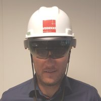
Building industry has great need for better communication between the various actors in projects, it is not uncommon that errors occur caused lack of good information quality. Øyvind's passion for visualizing BIM and project information through AR makes new opportunities for common understanding between people in the building industry. There is no specific form of information that is appropriate for all tasks in a building project so Øyvind develops processes for AR devices and other mobile devices into a common process for digital dataflow and BIM visualization. Øyvind is BIM-manager at Veidekke Entrepreneur. Graduated Construction Engineer from Gjøvik University College and has a diploma in the carpentry profession. When Øyvind jump out of the virtual world, he likes to go skiing in the mountains and compete in sports.
Abstract: Augmented Reality for the Construction Industry
The basics of AR for a construction project
AR change how we interact and can rely on the information in a construction project.
The basic information we use in AR such as a BIM-model is the same, however we gain huge benefits when placing the BIM-model in the real world at right scale and position. One of our goals is to make the interaction between different stakeholders as accurate and easy as it possible can be. To reach that level of accuracy we need the best platform to do the information transfer from team to team or person to person. Our perception is that the best platform for geometric description is AR, and we use that advantage to perform construction tasks easier, faster and better.
AR in use for better understanding and reducing rework
To maximize our BIM investments, we have start to use AR in some areas in the construction process. For example, to erect and control the rebar assembly. We also use AR to track progress and reduce the rework of heating, water and sanitation.
Alignment of the BIM-model in AR with GPS
To use AR on site in infrastructure projects, the ability to place BIM-models automatically with centimeter-precision is necessary. We do piloting a new tool who combine AR on smartphones and a GNSS receiver. This device brings us the precision needed to do planning, production and inspection of any work in an infrastructure project.

Olli Poutanen is a Helsinki-based designer who is passionate about applying game thinking and new media technologies in urban design. Poutanen works at WSP, which is a globally recognized professional services firm. In 2015 Poutanen started building a team of technology experts, designers and artists that has since then been established as a business unit called WSP Game Studio. The focus of the studio is in providing interactive content that facilitates design of urban environments and architecture with virtual and augmented reality solutions. Poutanen typically runs projects that combine various media solutions tailored for different phases of the project lifespan.
Abstract: Immersing in Architectural Lighting
In carefully chosen places, lighting can stand out as a beautiful layer on the surfaces of the urban landscape. Since technologies of addressable and individually controllable light emitting diode (LED) luminaires and intelligent lighting control systems are developing, new possibilities also emerge in architectural lighting design. Consequently, designers need to find ways to assess dynamic changes of lighting that can be perceived, for instance, as changing colors or in shapes the lighting paints to the surface. It is reasonable to study their effects to the cityscape and user experience as a part of the design.
In order to tackle new design challenges, the lighting team and the in-house game studio at WSP Finland have joined forces. Together, these teams of experts have developed interactive lighting visualizations that enable designers to look at different lighting scenarios and prototype with alternative sketches. This presentation focuses on two case examples that demonstrate how game engines have recently been used in façade and bridge lighting design projects with the help of augmented and virtual reality. Both of these lighting designs include dynamic control of the luminaires that have been brought to life in a virtual environment.
Léon had a construction background, but found ICT in the AEC industry equally interesting. Today he is leading BIM innovation initiatives at the Netherlands Organisation for Applied Scientific Research TNO. His main research topic is collaboration in the AEC industry. Léon is the founder of the open source BIM collective and BIMserver.org. Recent works are on the fields of cloudbim technology with "BIM Bots" and several EU supported BIM R&D projects. Recently Léon started leading the "BIM Supporters" organisation on its mission to improve the quality of BIM usage worldwide, by using tools like the BIM execution plan generator, the BIM Quickscan® and the e-Courses program BIM Secrets.
Abstract: Sharing is not collaboration The cloud seems the new holy grail as a facilitator for sharing BIM data. Online platforms however will not instantly create a collaboration environment. Every partners needs to adapt to the system, which can be different in every project. It is a challenge to get everyone on the same island and abide by the same rules for the time they spend there. Research and practical observations show that working with on online cloud collaboration platform stimulates wrong behavior. People just put data on it as if they are throwing it over the wall to others. The real challenge is to map requirements between people in a project, and work towards delivering them. As long as people can't deliver data that other project participants need, they might never be able to deliver an integrated project. The pitch gives some examples and solutions how to actually collaborate and deliver the correct data to project partners, regardless on what cloud island they are.
As Lead Digital Project Management at Count & Cooper responsible to effectively leverage the power of technology as a key factor for successful project delivery. Broad BIM experience in both local and international (Middle East) environments. Currently working on large scale infrastructural projects with a focus on data-integration and 4D planning (risk prevention through virtual construction). I am passionate about new technologies, process improvements and team-work in highly complex environments.
Abstract: The importance of 4D in large infrastructural projects 4D, integrating time within our 3D BIM models. Why is this becoming more and more important in large infrastructural projects? We will show you how and where this benefits a project with a real-life example. We will take a look at all of this from a project controls / project management perspective, through do’s and don’ts. 4D transforms our industry in ways we can’t imagine.

A civil engineer with 18 years of experience in construction industry. All my career is driven by technical innovations in order to keep a step forward.
Since 2006 I have been working for Bouygues Construction, worldwide construction company, with HQ in France. As a Head of R&D, I led the conception and management of R&D portfolio in close collaboration with international universities and startups. I introduced and coordinated the set-up of high-tech products (VR, drones) to a large international audience and contribute to the activity of 8 global and transversal R&D clusters.
In my current position, I lead the global deployment of BIM (Building Information Modeling) by working with cross-functional teams both in France and in International. The technology know-how adoption and digitalization of internal processes is one of the main goals to be delivered to increase the business performance. Recently I've returned to University to study the intersection of digital technologies and disciplines of the humanities.
I hold a Master degree of Civil Engineering from Warsaw University of Technology and an Executive Master of Digital Transformation from Sciences PO in Paris.
Abstract: BIM – Digital value in construction sector The companies and largely construction’s profession embrace a radical change regarding BIM technology adoption and process makeover. They understand the value added of BIM in different project phases.
BIM is a common thread that connects all actors. Within Bouygues we all know that 75% of a structure's building cost within 20 to 25 years is maintenance and operating costs. That's why we consider as vital the integration of the maintainer's requirements into the design phase.
With the wide-scale adoption, BIM could be considered as knowledge resources of physical and functional characteristics of buildings and environment and so could allow exploring the vast potential of geo-design.
However the BIM implementation requires more than just implementation of new IT tools. Today we deal with 2 main challenges:
First: The variety of BIM tools and BIM related solutions represents an important and agile market, therefore the companies as our, are still learning how to navigate properly in this changing environment.
Second: The organisation have to work all areas of business: management, people and culture in order to establish a new vision of business, then engage external stakeholders, and make collaborate partners and internal teams in order to achieve this common goal.

As Director Design & Engineering at Ballast Nedam, Paulus Eckhardt his focus area is integrated design, construct and maintenance. For this, he involves as many relevant departments within the organization as possible. Other important focus is to increase productivity and reducing costs. To reach both focus areas, Paulus' key to success is digitalizing and BIM4Project.

Mr. Heikki Halttula (M.Sc.) has over 30 years' experience in civil engineering CAD, GIS and BIM -software development projects, and lean implementation projects. He is CEO of Viasys VDC Ltd. since 1999. Viasys VDC is today part of Topcon Position Group and is concentrating on MAGNET software development. He has acted as chairperson of the Data Modelling Committee of Finnish Association of Civil Engineers for ten years and has been a member of Building Smart Finland Infra committee advisory group. He is also Ph.D. Student focusing on the simultaneous use of BIM and Lean.
Abstract: Virtual Design and Construction in Infrastructure Projects During the past few years, the construction industry has been actively focusing on improving productivity with new model-based technology solutions. The proper use of Building Information Modelling (BIM) technologies greatly improves risk management of construction projects with frequently reported benefits such as cost reduction, increased control, significant time savings and minimization of waste throughout the project lifecycle. Virtual design and construction tools, such as the MAGNET software family, help businesses to turn 2D drawings into high-quality constructible models, eliminate clashes and design defects and to monitor the project progress even in 4D and 5D views by including project schedule and costs. Furthermore, MAGNET software enables mass optimization, production of machine control surfaces and – with the help of UAV surveys and laser scanning - the creation of as-built 3D models that when combined with the initial design models allow project management to review the quality of work.

Aki ensures that Kreate is at the top of the infrastructure contractors by utilizing new digital and intelligent solutions in construction. The application of building information models (BIM) in project lifecycle is an essential part of this development. An example of Aki’s contribution to comprehensive implementation of BIM is the Isoisänsilta bridge project, which was designed and built entirely with BIM. The project won the Tekla Global BIM Awards 2015, awarded by Trimble and the Bridge of the Year 2017 awarded by RIL - Finnish Association of Civil Engineers. Along the ongoing developing of utilizing BIM in Kreate, Aki designs temporary support structures and scaffoldings for Bridges with Tekla Structures. This brings hands on approach to BIM in projects and guarantees well designed supports while minimizing waste.
Abstract: Tampere Deck and Arena – construction project over railways – providing the right information to make the right decisions
BIM's role is to provide the information for managers to help make right decisions. This is the key in making the project successful. The construction industry's processes haven't really changed, but the conditions and circumstances in which the projects are conducted have. We are building structures among already densely built areas and in tight schedules. Good spots for buildings are already taken. This is why we need help from the modern tools to make projects profitable. This is just the case in Tampere Deck and Arena project.
Kreate conducts the construction project of the deck over the railways of the Tampere railroad station for SRV. This central deck will house a multi-purpose arena, a hotel, and the city's tallest residential buildings. The deck itself is a very demanding engineering marvel containing 10000 meters of drill bored piles, 20000 cubic meters of cast reinforced concrete and these are constructed over and in between working railways. The layout of deck foundations are under constant change, since the designs of the arena, hotels and the residential towers are still to be finalized.
Can collaboration via BIM help to face the challenges of tight schedule and changing designs? The design models are shared in BIM cloud with the project stakeholders, but sharing huge amount of data itself doesn't help the project management. Kreate has developed practical solutions with the designer Ramboll to provide on time data of the project status for the site and the client through BIM visualizations. Through these visualizations the status of the design, construction work and material orders are checked in weekly meetings. This way the project management stays on top of the project progress and can make properly considered changes in plans when needed.
BIM Leader in civil department railway infraestructures in Sener. Postgraduate Máster BIM Management in Infraestructure and Civil Engineering. Engineer specialist in the development of infraestructure projects over more than 25 years.
Abstract: Integration of GIS tools into BIM infrastructure models
The future of engineering is based on BIM methodology. In order to achieve good engineering projects, the first stage is to define an adequate and accurate cartography and geology-geotechnical information.
Here in SENER, these engineering fields are the core stone in order to provide value and reliability to the projects. SENER has developed an in-house tool called "XBIM-GEOSENER" which allows to obtain 3D geological-geotechnical BIM models
The BIM model integration in a GIS working environment allows to link BIM with multiple databases and their accurate analysis. In this way, information can be managed and analyzed jointly and continuously, providing the engineer with an improving analysis capacity and a better decision making skills.
The final model contains all relevant geotechnical data, the BIM model of geology obtained from the existing geotechnical information, and the infrastructure BIM model , in order to reliably manage all the project information available to make any geotechnical-structural calculation process automatic in any infrastructure project.
M. SC. Eng. Geodesy and Cartography. Postgraduate Specialization Railway Engineering. M. SC. Eng. GIS-ESRI. She has 17 years professional experience in Surveying and Mapping related with civil works. Being Responsible for the Surveying and Cartography Department since 2007, has also taken part in numerous detailed design projects and feasibility studies of railway lines and High Speed Trains, toll highways and motorways, roads, subways and also Airports.
Abstract: Integration of GIS tools into BIM infrastructure models
The future of engineering is based on BIM methodology. In order to achieve good engineering projects, the first stage is to define an adequate and accurate cartography and geology-geotechnical information.
Here in SENER, these engineering fields are the core stone in order to provide value and reliability to the projects. SENER has developed an in-house tool called "XBIM-GEOSENER" which allows to obtain 3D geological-geotechnical BIM models
The BIM model integration in a GIS working environment allows to link BIM with multiple databases and their accurate analysis. In this way, information can be managed and analyzed jointly and continuously, providing the engineer with an improving analysis capacity and a better decision making skills.
The final model contains all relevant geotechnical data, the BIM model of geology obtained from the existing geotechnical information, and the infrastructure BIM model , in order to reliably manage all the project information available to make any geotechnical-structural calculation process automatic in any infrastructure project.

Tiffany Hosey is a business executive, lawyer and recent innovator in construction analytics. While working as a civil litigator for over 15 years, her experience ranged from the defense of professional liability cases to serving as counsel to a panel of judges overseeing a multi-billion dollar products liability litigation fund. Before founding BuilDATAnalytics, she worked for 7 years as President of her family's construction management company.
Tiffany created CTBIM out of her need for an evidenced based approach to construction. While working with her family's construction company, she was often challenged by the lack of accountability controls, cost controls and paucity of information on routine issues prevalent on most construction projects. After creating CTBIM, BuilDATAnalytics was chosen out of over 250 competitors as a winner of the 1st Ballston BID Launchpad Challenge, sponsored by Ted Leonsis and the Ballston Business Improvement District.
Tiffany has been a guest lecturer for the Strategy and Entrepreneurship program at Marymount University School of Business Administration, and has presented a webinar to the Department of Construction Science at Texas A&M.
She holds a Class A Contractor's license from the Commonwealth of Virginia; is certified by the U.S. Army Corps of Engineers in Quality Control Construction Management; is proficient in written and spoken Japanese; and holds a J.D. from The George Washington University Law School and a B.A. in English Literature from Georgetown University.
Abstract: Insurance Driving 21st Century Construction Innovation: Using Big Data to Mitigate Risks and Increase Labor Productivity Insurtech that utilizes Big Data in construction is poised to disrupt the insurance and construction industries. Historically, insurance companies have served as catalysts to changes that have driven mandated improvements on construction sites. Years ago, six-foot fall protection became an insurance requirement in response to the numerous claims asserted due to preventable falls on construction sites. In the advent of Insurtech, technologies that collect real-time Big Data from field activities can also be mandated to drive efficiencies. Technologies that collect real time field data can streamline claims processing, decrease litigation costs, bring more competition to the marketplace and ultimately disrupt the business of construction. Technologies that allow project teams to proactively address issues during the construction process can mitigate insurance and financial risks inherent in the construction process. Big Data also brings an exciting prospect of allowing developers to store real time evidence of completed construction activities in the event of a catastrophic loss before project completion. By requiring the collection of Big Data during construction, insurance companies are poised to not only disrupt the way insurance companies have done business for 300 years, but also how the construction industry has conducted business for over 2000 years.
Director of Digital Delivery at Bryden Wood, responsible for driving digital innovation across the practice. Phil leads the Creative Technologies team at Bryden Wood which brings together different strands of BIM and computational design including algorithmic design+simulation, connected tech, mixed reality and big data analytics. This group is focused on developing radical new approaches to digital technology that can be used by both the design/delivery teams and clients/end-users.
Abstract: Data Driven Infrastructure and Automated Design
The Rapid Engineering Model (REM) is a radical and disruptive new digital approach to automated design for Highways England, developed by Bryden Wood Technology Ltd with the Smart Motorways Programme (SMP).
Central to the functionality of REM is the design guidance documentation that has been developed for the SMP. This guidance has been encoded into a rules engine that drives two key aspects of REM â?" data analytics and automated design. Topographic data can be analysed alongside environmental data to help identify opportunities and risks within specific projects or along entire assets in the network.
The step-by-step Rapid Engineering Model process is as follows;
1. Analysis of digitally captured topographic and environmental data
2. Evaluation of suitability of topographic data analysis
3. Automation of design layout, following SMP design rules
4. Optimisation of design layout according to project specific criteria
The REM workflow is organised around a 'master data set' which captures the analytics, evaluations and optimised layouts. From this, REM can generate many different outputs types and formats, including;
- GIS data layers
- HE compliant BIM models
- Interactive, browser based data visualisations
- 'Drive through' visualisations
- Mobile and web apps
- Virtual Reality apps
Anne has been working in the industry for 25 years, delivering information to where it is needed for informed and intelligent decision making. She is Director and Fellow at Atkins for BIM Strategy and Implementation. She has been with Atkins for 19 years, where she first introduced GIS to the business, and has acted as advisor to a wide range of projects, ranging from contaminated land to large data management projects. Having served two years as Chair for AGI, Anne is now Vice Chair of Building Smart UK and Chair of ICE's BIM Action Group and BIM4Infrastructure UK. She has been part of the UK Government BIM Task Group helping the departments to implement BIM, in particular HA and EA, and has just graduated as prizewinner for her MSc in Coaching and Behavioural Change at Henley Business School, where her research focused on enabling sustained collaborative working across the infrastructure industry.
Joana Menéres Pimentel de Melo, civil engineer at Instituto Superior Técnico–Lisbon-Portugal.
I have always worked at Somague, part of Sacyr Group. First as a budgeting and planning engineer, then as designer and external designers coordinator, and also as coordinator at some of this construction company’s works (site works), even in São Paulo, Brazil.
Through the coordination tasks I’ve got interested by technologies and methodologies applied to data, resources and costs management.
When Somague partnered up with Instituto Superior Técnico for developing and studying BIM in Portugal, I’ve joined the study group.
As responsible for BIM implementation at Somague, I’ve taken part in BIM work and study groups, such as the BIM Work Group at the Technological Platform for Construction in Portugal and the Portuguese BIM Committee and also participated as speaker in training and informative conferences (BIM in a construction company) at some Universities amongst other events.
I’ve recently (2 years now) moved to Madrid, to Sacyr’s Headquarters, with the responsibility of implementing the BIM Department and developing the methodology within Sacyr Construcción, across all works worldwide.
Abstract: Information along with Time and Place We have BIM and we have the information within the BIM models, but as a construction company we have all the “other” information generated on site along the construction time of a project.
Time and Information are money and we must be able to gather and coordinate as much information as we can to support us on our best/ on time/ and final decisions.
With all these new technologies and apps available in hand, within a touch, so easy, so fast…. we are unable to process such amount of information and still have time…. to work!
So, infinite more Information in infinite less Time becomes dark data… somewhere, somehow available for someone… but not us.

François Robida is a mining engineer and geostatistician, and has 25 years of experience in computer science applications to earth sciences with BRGM (French Geological Survey). Following his first work in mining geostatistics, he has been in charge of the design and development of software and programs related to all aspects of geology, and especially to 3D modelling. He was then been responsible for the BRGM software group, a team co-ordinating the development and marketing of software developed by BRGM. In his current position, he is in charge of the R&D and of the European projects in the domain of Information Systems for BRGM.
As "Terre Virtuelle" project leader (Terre Virtuelle / Virtual Earth is a BRGM R&D corporate project to support the development of new services through the use of new technologies), François has been promoting and has introduced interoperability, Grid and Virtual Reality technologies within national geological survey. Involved as an actor of the development of interoperability at different levels, he is a member of the European Expert Group for INSPIRE (the initiative of the European Commission to develop European Spatial Data Infrastructure), where he represents the European geological surveys association (EuroGeosurveys). As representative of BRGM in OGC (Open Geospatial Consortium), he is also a member of the OGCEurope advisory board, and member of ADAE-CNIG (French counsel for geographic information) working group for geospatial interoperability.

Benjamin Friedman is the CEO of Geo-Impact as well as one of the first students in the University of Southern California’s undergraduate B.S. in Geodesign. Having worked both in planning and tech entrepreneurship, he saw the opportunity to create a ‘Sim City for the real world’ a technology aimed at bringing the power of data and science to city planners.
Abstract: Creating a Sim City for the real world To design cities with a data and scientific backing, we need to package the data and science into tools that make sense to city planners. You can give planners as many papers and data sets as you want, but they think in terms of plans, policies, and interventions. What we need is a Sim City for the real world, a tool where a planner can sketch out a land use and transportation plan and immediately see the plan’s impact on important metrics like car usage and pedestrian safety. That is what I am building. Geo-Impact is a 3D urban digital twin where planners can test out ideas and see how they will affect the community. At the speed of a sketch, the program uses context data to compute the effect designs will have on various metrics important to the project. The feedback that currently takes a team of consultants will now take a few seconds. With this kind of tool, we will be able to speed up the iteration of urban plans and build better cities in the process.

Luke Cooper is a Digital leader at Arup and specialising in data governance, IT architecture, data manipulation, analytics, visualisation. He has a strong background with data capture, storage, manipulation and visualisation leveraging geospatial, big data, XR (VR/AR) and cloud technologies. He strives for holistic and simplistic solutions to meet the needs of complex problems drawing on techniques to promote lean processors, gaining efficiencies across the project and asset lifecycle. He has worked across numerous sectors and bodies including Network Rail, Highways England, Welsh Water, Welsh Government.
Abstract: Crossing the streams The use of digital technology is driving our understanding and utilisation of the built environment. A step change is now being seen across the industry that allows data to kick start innovation across the asset lifecycle, giving meaningful efficiencies and benefits. With external pressures, all parts of the engineering sectors are becoming increasingly proactive in how technology, methodologies and skills can be utilised.
Digital approaches of data accessibility, utilisation and analysis have been embodied in examples rail electrification work with Network Rail (UK) and Highways England now have been expanded upon to ensure data is orchestrated and connected not only to the individual organisations but by anyone on any device anywhere.
This talk will address how this deep profound change is touching areas from feasibility to facilities management from retrofitting existing buildings to designing of new transportation links to support our future needs. It will share stories from property, transport and cities across the asset lifecycle and share how Arup is putting people at the heart of the digital transformation and how with this great acceleration needs to be supported further.
Started his career as a Design Engineer at a small design firm in 1999, rose his designation to Production Manager along with the company’s positioning in respective market in next 5 years while gaining a great deal of experience in implementing processes, building & managing teams. Graduated from Bangalore University with a bachelor’s degree in Mechanical Engineering, he is always keen on engineering and management processes.
Founded Clove Technologies in 2004 and has been an eminent factor in conceptualizing and implementing many innovative methodologies and acclaimed processes. From its humble small beginnings, Clove is now a global sizeable Geo-BIM-Tech Organization.
Tessa Eikelboom is responsible for the development of generic geo applications that are used for the exchange, quality and availability of geo information. She is also starting up Geodesign projects to support for instance Infrastructure Maintenance Planning. She likes to integrate different disciplines using smart technologies. In 2015 she defended her PhD thesis "Interactive geodesign tools for regional adaptation strategies" where she used an interactive mapping device, "Touch Table".
Abstract: Exploring the power of visual geo innovations for smart infrastructure management Infrastructure management is a data-driven activity that involves multiple stakeholders. The long list of upcoming renovations and maintenance projects asks for prioritizing and smart decisions. Technological developments such as smart sensors, LIDAR, dronemaps and image recognition improve the ability to analyse the as is situation and occurred changes. Digital twins, virtual and augmented reality can support identification of future states and with use of the power of imagination these tools can support visualizing the potentials for change. However, to answer to the need for accessible and innovative user platforms, tools are depended on the quality of their sources. Rijkswaterstaat is experimenting both with data and applications to build an accurate and reliable backbone to operate and maintain infrastructure. The main challenge for new tools is to design them such that they are able to link multiple variables ranging from climate change to local permissions and still visualise the impacts in an understandable way for various disciplines in a single interface at the same time.

In the INSPIRE context the Keyregistry of the Subsurface of the Netherlands can be seen as a "reference data theme” as it provides information for several other INSPIRE data themes e.g. Mineral resources; Area Management, Restriction and Regulation Zones; Natural Risk Zones; Soil; Energy resources, Geotechnical properties. In Geology there is a specific relationship with one of the most important natural resources, water, through groundwater bodies contained in aquifers. The theme also covers geomorphology that describes the Earth’s present-day surface, and the location of the geophysical campaigns and measurements that provide valuable information on the physical properties of rocks (like density, porosity, magnetic susceptibility, etc.) regardless of their organization as geologic units.

Rob Strijker, 42 years old, has worked for RWS since 2015 as senior programmer. A RWS-Programmer programs, prioritize of- and formulates advise for the decision-making in the investments (budget and people) in the RWS infrastructure area. Rob Strijker has a broad experience in non-profit public-transport and infrastructure management (Province of Overijssel en Flevoland) and as college teacher.
Abstract: Using Geodesign to Facilitate Cooperation between Authorities Responsible for Infrastructure Management in the Province of Gelderland Construction and maintenance of infrastructure involves many stakeholders and participants. These stakeholders/participants have different interests, knowledge and different responsibilities. This project creates a relative easy to understand platform and brings together stakeholders from the provincial authority responsible for the regional network and from Rijkswaterstaat responsible for the national network. Although both networks are highly interdependent both authorities have very different planning strategies and to a large extent ignore the spatial relations between both networks.
To support integration of both planning approaches a geodesign tool was developed that combines spatial information relevant for infrastructure management. This tool works in two steps: first participants are asked individually to provide input on their priorities using their own laptop or smartphone with the ESRI web app. This input is processed and presented using ESRI ArcGIS Pro. The maps generated are transferred to a touch table and made available as an interactive map. This map is used as the starting point for further discussion. Participants interact with this map by drawing on the map and by adding symbols to the map. The tool proved instrumental in exchanging information and in the formulation of a joint approach to the issue.
The long-term ambition is an approachable platform to a well-functioning digital twin of the infrastructure assets and their surroundings for designing new solutions, simulating them and co-decision-making.
Harry joined Zaha Hadid Architects in 2014. As Head of BIM, he is responsible for strategically directing the office’s technology workflows, for better efficiencies and best practices across BIM, CPU, GPU computing and cloud collaboration. Prior to ZHA, Harry worked for Mace Group on the construction documentation as an Architect, heavily focusing on the client side and 4D – 6D BIM level 2 workflow project delivery. Harry has been integral to various high-profile projects at ZHA and is currently working on Navi International Airport and Sberbank Technopark. Harry received his MArch of Urbanism and Architecture in 2010 from University College London and is a registered Architect in the UK. He is also a mentor and advocate of the knowledge transfer partnership.
Abstract: ZHA BIM Group fluid BIM Level 2 workflow Brief preview of ZHA BIM Group fluid BIM Level 2 workflow, polygon modelling to Nurbs design development with Parametrical modelling control. Downstream workflow for a fully coordinated, collaborative full BIM Level 2 BIM LOD 350 clash detected BIM Federated Model, overview of Production and Automation insight. The workflow has matured since 2007, developing with the technology progressions in the AEC industry, as well as, improving with assistance from Multimedia, automotive and aerospace technology influences.

Gustavo Arciniegas has a PhD in map-based decision support tools for collaborative land use planning. Independent consultant in Geodesign. Consortium project partner in h2020 project REPAiR, led by TU Delft which focuses on integrating Geodesign, Life Cycle Analysis and Living Labs for metropolitan waste management in European cities.
Abstract: Integrating geodesign workshops into a Peri-Urban Living Lab for improving waste and resource management in the Amsterdam Metropolitan Area This article reports on the progress of a series of four collaborative geodesign workshops organized as part of an ongoing living lab to develop integrated place-based eco-innovative spatial development strategies aiming at a quantitative reduction of waste flows (food waste and construction and renovation waste), as well as an improved metabolism and spatial quality of wastescapes in peri-urban areas of the Amsterdam Metropolitan Area (AMA). The four workshops focus, respectively, on co-exploration, co-design, co-production and co-decision. Private, local and regional stakeholders discuss resource management challenges of the AMA, and co-design strategies to address these challenges using support tools implemented in large touch-enabled digital surfaces. The support tools are part of an interactive web-based database and user-interface system called Geodesign Decision Support Environment, which allows workshop participants to: 1) get informed about the status quo of the AMA in terms of key material and waste flows, as well as social, economic and environmental sustainability; 2) co-design eco-innovative solutions (EIS) to address challenges of resource management; 3) numerically assess life cycle effects/impacts of the application of these EIS, as compared to the status quo; 4) allow comparisons between different strategies; and 5) encourage informed decision making on future strategies for the AMA.
Sarah Gottwald is a PhD student at the Insitute for Environmental Planning at Leibniz University Hannover. Her background is in Geography and Environmental Planning. Her research focuses on the integration of the theory of sense of place in spatial planning processes. She uses modern technologies such as Public Participation GIS online surveys and digital Geodesign tools and workshops in her dissertation. Her dissertation is part of the transdisciplinary PlanSmart research project. @PlanSmart_Info
Abstract: Geodesign as a bridge between citizen values and expert knowledge in planning of sustainable river landscapes River landscapes are complex systems where various stakeholders with their different interests and knowledge types are involved. This requires a planning approach integrating different knowledge types. Geodesign may act as a boundary management process between science and practice, and citizen and professionals by translating information and promoting a common understanding and conflict mediation. Therefore the aim of this study was to present and evaluate a Geodesign tool and workshop process aiming at bridging and integrating different types of knowledge for designing sustainable river landscapes. In a Geodesign workshop, eleven participants from different administrative bodies used two touch screens to design spatial scenarios. Participants worked with GIS data gathered from local citizens (e.g. activities) and official sources (e.g. land uses). They were able to draw on the map and change land uses. The land use changes led to immediate feedback on a selected set of locally relevant ecosystem services helping participants to reflect on the impact of changes. The resulting maps, observations and the evaluations by participants reveal that the Geodesign workshop and tool provided a creative environment allowing participants to develop and discuss solutions. It is however crucial that the system is transparent and technical errors kept to a minimum.
David is the Regional Manager of Europe North for FARO Technologies. He has been involved in the 3D data capture world for over 16 years and started at FARO in 2005. David has been heavily involved in BIM since 2011 when the UK Government published its Construction Strategy. He was also a contributor in the original “clients guide to 3D laser scanning and data capture” in 2013 that was published by the UK task group backed by UK Government. A futurist and technologist, David has a keen interest in not only hardware data capture systems but fully collaborative software solutions that ensure the data is fully utilised throughout the process.
Abstract: FARO - Traceable Construction We’ve evolved and reshaped ourselves over the past few years to focus on providing complete solutions to construction industry professionals along the building life cycle. With FARO’s Traceable Construction solutions, we create a consistently structured set of verified data, which will be a big boost for construction accuracy. This will result in less time and money wasted at the construction site, achieving not only a better construction quality but also a higher Return on Investment.
Menno de Jonge (1961) holds a Bachelor degree in Civil engineer and finished his Master in Building engineering at the University of Eindhoven. He has 30 years of experience in the construction sector, of which 25 years in different functions on the interface of IT and Construction, in the Dutch con¬struc-tion company Ballast Nedam. After working with Autodesk fort wo years, Menno is appointed as Director Digital Construction at Royal BAM Group in 2016. The focus in his career has been on the interface of IT and Construction, and he has been working on the Digital Transformation of the industry.
Menno is also active as Board Member in ENCORD and is Chairman of the Board of buildingSMART Benelux.
Abstract: Building the Present – Creating the future, transforming the way we shape our built environment There is an urgent need to transform the way we shape our built environment. Royal BAM Group is taking a leading role in the digital transformation of the industry. We are building the present while we are creating the future. We “make it before we make it”, in other words: we built it Digital first, before we are going to build it Physically. In the short presentation the WHY, the HOW and the WHAT are discussed, and examples of using digital technologies in real projects are discussed.
BEng (Hons) in Mechanical Engineering. Worked on major projects including designing radio base sites for major mobile phone operators. Major building infrastructures & Rail projects, London Underground power upgrade, Crossrail, Network Rail projects and currently working on HS2 project. Senior CAD Tech/BIM coordinator at Source Design Services, part of Kier Group. Part-time student at University of Westminster University, MSc on Building Information Management.
Abstract: Benefits of Integrated BIM and Geospatial For Infrastructure Projects More than 4 million excavations are carried out on the UK road network each year to install and repair various utility services. Damage to these services causes practical problems that increase costs and delay projects, more importantly; it increases the risk of injury for utility owners, contractors and the public. The future lies in 5D BIM. 5D BIM technology combined with Reality Modelling (RM) and Geo-location offers a way of providing the full life-cycle BIM modelling reducing public infrastructure costs over a lifetime of facility by considerable percentages.
This paper will address the benefit of integrated BIM and Geospatial for the infrastructure projects:
• Register and keep existing asset information for future projects to access the data and protect the services.
• Get the full benefit of BIM not only on building construction projects also on infrastructure projects such as Crossrail, HS2.
• Used in building retrofit projects to put together as-is geometric BIM data and other necessary data into GIS and other mapping utilities.
The benefit of integrated BIM and GIS on creating Smart Cities, including the technology used to survey and mapping all these information. and the process of migrating information from survey tools and BIM environment will also be discussed.
As Director Design & Engineering at Ballast Nedam, Paulus Eckhardt his focus area is integrated design, construct and maintenance. For this, he involves as many relevant departments within the organization as possible. Other important focus is to increase productivity and reducing costs. To reach both focus areas, Paulus' key to success is digitalizing and BIM4Project.
Abstract: 4D Scheduling: The importance of Temporary Construction and Material
Saana Vuorinen is the Maintenance Manager of the biggest universal port in Finland, Port of HaminaKotka. She's responsible for the maintenance of the port infrastructure, allowing customers to enjoy their business in excellent conditions. The port infrastructure consists of waterways, roads, general port areas, rail connections, quay and berth structures and related equipment.
Saana has held various positions in the port business since 1997. She has experience from stevedoring and working as a port engineer, with wide responsibilities both in administration and the actual operations. This has given her a strong understanding about the needs and activities of different stakeholders in the port environment.
Saana holds a Finnish Bachelor's Degree in Forestry Engineering. During her studies she participated in foreign exhcange at Hildesheim-Göttingen Polytechnic University, in Germany.
Abstract: Introduction of the BIM software used at Port of HaminaKotka Port of HaminaKotka uses a browser based program that allows 3D visibility of all underwater structures at the port. The port has recently launched a project that will add aboveground structures and buildings to the program environment. This will be of great benefit in the daily operations at the port.
Tirza van Daalen is the Director of the Geological Survey of the Netherlands TNO. She received her mSc in Geology in 1994 at Utrecht University. Before joining the GSN-TNO in 2009, Tirza van Daalen worked in IT as a management consultant and has been active as publisher in Geoscience for Elsevier Science. She has extensive experience in management of innovative projects. Most notably, she is currently leading the development of the new Dutch "Key register of the Subsurface" (Basisregistratie Ondergrond; BRO). This central facility for all public data on the subsurface in the Netherlands is unique in the fact that all public organisations producing. data on the subsurface will be required to deliver these, through web services to the BRO. Public organisations will also be obliged to consult the BRO before acquiring new subsurface data, e.g. for building permits. The BRO builds in the current DINO (Digital Information on the Netherlands Subsurface) database, which already holds a worldwide unprecedented density of data on the subsurface in the Netherlands.
Ronald van Lanen works as a consultant geo-ICT and information management for Royal HaskoningDHV. With more than 20 years of experience he worked as a consultant at different organisations. He uses knowledge of standards like INSPIRE, data, BIM, Geo-ICT solutions, Scrum and innovative methods like linked data as improvement tactics to achieve the implementation of the digital transition.
The last years he was involved with the BIM program of Rijkswaterstaat working on an object type library (OTL) and research program European project.
Abstract: How geo-bim can help infrastructure assets to become important in realising global sustainability goals such as bio-based economy The organisation Rijkswaterstaat, the ministry of infrastructure and Water Management are responsible for the main infrastructure facilities in the Netherlands. Apart from managing roads, one of the assets for which Rijkswaterstaat is responsible is the roadside. Traditionally the roadside fulfils traffic functions of which the most important one is increasing safety.
But what if assets can provide additional functions such as biomass production for the industry, production of solar energy or becoming a restricted zone for a protected site? In this presentation we give a brief overview of the challenges arising when the aim is to obtain additional sustainability functions from roadsides. One of these challenges is the difficulty obtaining the necessary information to determine the impact of new functions (during the lifecycle) allowing for informed decision making.
Can geo-BIM contribute to better information collaboration (interoperability), stimulate re-use of information to avoid inefficient data management? To show that we found that geo-BIM can make this contribution, we briefly demonstrate the results from projects where the aim was to optimize creating additional functions from roadsides. We show how new innovations like I-report, an object type library (OTL’s), linked data and integrating with GIS and the transport network as a backbone can provide the data management functions which are needed.
As shown is several projects, the digital transition is fundamental in achieving other global transitions such as the energy transition and creating a bio-based and circular economy.
My name is Jan van den Brandt. I’m the General Manager for Infrakit B.V. (Benelux area) and business development manager for German speaking countries and UK/Ireland. My lifetime experience is in automation of workflow in many different branches, from steel factories, machine building, shipyards, paper factories and waste to energy factories. Since 2016 I’m active for Infrakit to help infra industry to use BIM in project execution. It is my vision to make this world better with a better workflow for infra construction projects to create a transparent cooperation between Project owners, designers, contractors, sub-contractors, quality control, asset managers, etc.
Abstract: Infrakit – The Open BIM Cloud Infrakit is an open Cloud application for the infrastructure industry to make collaboration and sharing information possible in a brand independent way and with a good amount of automation that is useful for the industry and the project owners.
Traditionally and still in many projects sharing information consists in a lot of papers and drawings in a large number of files somewhere in the office creating a lot of searching and often resulting in finding outdated information. Also, machines on the worksite very often get new information too late leading to high failure costs, stand still costs and delays in projects.
Based on some projects in Finland and The Netherlands we will present some functions of Infrakit that are helping project owners and constructions companies to save a lot of problems during the project.
On project is a new build of tram track in Tampere Finland (VR Track) and the other is 42km new road in Noord Holland (Heijmans).
Both projects benefit enormous being able to share data and documents and to be sure all information is in one Cloud.

Michael Gaunt is a Senior Engineer at Mott MacDonald with experience in Information Management, Project Management and engineering design. Michael has led the implementation of Information Management on some of Mott MacDonald’s largest projects including Tideway East and currently High Speed 2 in the UK. As a Chartered Engineer and with experience in design delivery, Michael’s focus and passion is to capture structured and controlled design data which can then be used to generate management reporting metrics to drive efficiency. Michael also has a strong focus on Model Based Delivery which is captured in his recently published paper “BIM model-based design delivery: Tideway East, England, UK”, the project also won Bentley’s 2017 Be Inspired Award for BIM Advancements in Project Delivery.
Abstract: Changing behaviours through Information Management. A major project case study demonstrating improved project performance Michael Gaunt will use a design & build project case study from the UK to demonstrate how information management and integrated project delivery is key to improve project behaviours. Michael will focus on the use of structured data in a common data environment and the need for controlled but open collaboration to enable more efficient delivery methods. The success of the project is highly dependent on the behaviours of the project team. By connecting together project data including project controls, the management team can quickly identify issues and resolve within a continuously monitored environment. Ultimately achieving a more collaborative and successful project.
Francesca Noardo is Postdoc in the 3D geoinformation group at the TU Delft, and collaborates with the Amsterdam Institute for Advanced Metropolitan Solutions (AMS). She works towards the integration of geoinformation with BIM, envisaging the concrete employment of such technology for smart cities applications. She has a Master degree in Architecture (Restoration and Promotion) from the Politecnico di Torino (Italy) (2012), where she also obtained her PhD degree in Cultural Heritage (2016), developed in the geomatics research field. From 2013 to 2018, she made research in the geomatics group of the Politecnico di Torino. Her research was especially directed at the use of open standard data models and open technologies to archive semantic information in 3D digital maps. She is also the secretary in the Working Group WG IV/2: Ontologies, Semantics, and Knowledge Representation for Geospatial Information of the International Society of Photogrammetry and Remote Sensing (ISPRS).
Abstract: Geo and BIM does not make a GeoBIM Developing a coherent approach to GeoBIM integration requires consensus between multiple stake-holders from both the Geo and the BIM side and at an international level. Developing such a multi-country and multi-stakeholders approach is the topic of a 2-year EuroSDR (European Spatial Data Research) project on GeoBIM integration that started in November 2017. The general aim of the project is to detail both the needs and the issues of GeoBIM integration, studied from use cases as well as from existing experiences in the participating 11 countries and to develop initial solutions accordingly. We are specifically interested how geospatial data that is produced by governmental agencies like National Mapping and Cadastral Agencies (NMAs) can be better utilised in design and building processes. The studied use case are a) the workflow from global design to a building permit; and b) the workflow of the object life-cycle in asset management.
Arjen Adriaanse is currently responsible for developing and implementing the Arcadis Digital Strategy for Europe. Important aspects of the strategy are: BIM, Project Information Management, Data Analytics, Computer Generated Design, Smart Buildings, Smart Cities and Smart Mobility.
He is also Professor of Construction Process Integration & ICT at the University of Twente. His research focuses on more integrated ways of working and cooperating in the construction process and the possibilities of increasingly advanced ICT tools (like BIM) to support and boost these. Important areas of interest are organizational and change management aspects (e.g., what are organizational conditions for the successful use of ICT in construction, what are organizational effects, and how can these changes be implemented successfully?)
Arjen Adriaanse holds a PhD from the University of Twente. He has published in journals such as Automation in Construction, Construction Innovation, and Journal of Construction Engineering and Management. He is an often asked keynote speaker and conference moderator.
Ir Louis Smit is senior advisor geo-information and 3D at Public Works Rotterdam. He studied Geodesy at the Delft University of Technology. He began his career at Haskoning, royal dutch consulting engineers and architects in Nijmegen. He was manager of the GIS department and responsible for acquisition of Large Scale Base Maps projects. After that he was manager of the department of Geo-Information at Public Works Rotterdam. The department holds many Key-Registers like Topography, Adresses and Buildings, Small scale topography, Utility Basemap with all pipes and cables, Aerial photo’s etc. He is innovative and is the driving force behind Rotterdam 3D.
Aidan Mercer joined BuildingSmart International in 2018 and is currently the global marketing director. Prior to this, Aidan has held various roles in high-tech organisations including Bentley Systems and Exor Corporation. Previous roles included global marketing responsibility for AEC, geospatial and utilities marketing for infrastructure project delivery and asset management. Aidan’s responsibilities span the bSI brand to include the User, Compliance and Standards programs, as well as coordination for the various chapters. Aidan graduated with a bachelor’s degree in history and holds a master’s degree in marketing from the University of Gloucestershire and various CIM Chartered marketing qualifications. Aidan has written extensively on global topics such as BIM, Smart Cities and Going Digital as he aligns the company message to audiences around the world.
Abstract: An open approach to openBIM buildingSMART is an open, neutral and not-for-profit international organization that has led the development of geometric data exchange. It’s core Industry Foundation Class (IFC) standards achieved ISO approval in 2012 and through its growing global community, buildingSMART provides the environment for owners, software vendors, contractors and product manufactures to develop new standards through real-world projects. At its core, bSI promotes open digital ways of working in the built asset environment. In this presentation, Mr Mercer will explore the benefits of an open BIM approach to allow owner-operators of built assets, working with their service partners, to plan their capital investments and understand the likely whole-life costs of maintaining and using those assets for their intended process.
Hrishikesh Ballal is the Founder and Managing Director of Geodesign Hub Pvt. Ltd. Over the last few years, he has experience in organizing and participating in 80+ of geodesign studies of different scales and character. In 2015, he completed his PhD in geodesign from the Centre for Advanced Spatial Analysis, University College London. The main focus of his work is in systems approach to design and specifically in digital negotiations using design.

Henk is Board Member of the Amsterdam ArenA and specializes in facility and project management, preparation of project plans, maintenance concepts and planning. He manages the sustainability program which results in a carbon neutral stadium in 2015.
As consultant facilities and infrastructure Amsterdam ArenA International Henk is involved in various international consultancy assignments, such as: FIFA World Cup stadiums 2014 in Brazil, Salvador “Itaipava Arena Fonte Nova’’ and Natal “Arena das Dunas’’. Porto Alegre, Arena Porto Alegrense of Grêmio FC also in Brazil. Qatar, FIFA World Cup 2022, Stadium FC Shaktar, Donetsk in Ukraine, Stadium Spartak Moscow, Moscow in Russia, Olympic Stadium, Berlin in Germany and Multi-purpose Hall and Olympic Stadium, Amsterdam in the Netherlands.
Henk holds his degree in Business Science Electrical Engineering (1981). Before joining the Amsterdam ArenA, Henk worked for the City of Amsterdam as Facility Manager at the ‘Stopera’, City Hall and Opera House. Henk has been involved in the startup of facility management operations and leading of facility department.

Karolina Euler-van Hulst works as a consultant Sustainability for Royal HaskoningDHV. She graduated in 2008 from Utrecht University with a Master in Sustainable Development focussed on Energy and Resources. For 8 years she lived and worked in Johannesburg, South Africa, where she consulted government and companies from the mining and telecommunications sectors on sustainability issues. For Royal HaskoningDHV she currently focusses on the Energy Transition and Circular Economy and specializes in new business case development.
Abstract: How geo-bim can help infrastructure assets to become important in realising global sustainability goals such as bio-based economy The organisation Rijkswaterstaat, the ministry of infrastructure and Water Management are responsible for the main infrastructure facilities in the Netherlands. Apart from managing roads, one of the assets for which Rijkswaterstaat is responsible is the roadside. Traditionally the roadside fulfils traffic functions of which the most important one is increasing safety.
But what if assets can provide additional functions such as biomass production for the industry, production of solar energy or becoming a restricted zone for a protected site? In this presentation we give a brief overview of the challenges arising when the aim is to obtain additional sustainability functions from roadsides. One of these challenges is the difficulty obtaining the necessary information to determine the impact of new functions (during the lifecycle) allowing for informed decision making.
Can geo-BIM contribute to better information collaboration (interoperability), stimulate re-use of information to avoid inefficient data management? To show that we found that geo-BIM can make this contribution, we briefly demonstrate the results from projects where the aim was to optimize creating additional functions from roadsides. We show how new innovations like I-report, an object type library (OTL’s), linked data and integrating with GIS and the transport network as a backbone can provide the data management functions which are needed.
As shown is several projects, the digital transition is fundamental in achieving other global transitions such as the energy transition and creating a bio-based and circular economy.
Frank Weiss is based in Berlin. He is a Co-Founder of conject where he focused on product strategy and business development. In this time he worked and lived in Munich, Dubai, UAE, and St. Petersburg, Russia. In Aconex, which acquired conject in 2016, he served as VP for BIM Strategy and Development globally. Today in Oracle Frank Weiss is heading the global strategy for BIM & Innovation for the CEGBU - Construction Engineering Global Business Unit. He is a very curious and active person. He is internationally acknowledged as BIM expert and speaker. In his free time he likes running, yoga and bouldering which are great preparations for his hiking tours on holiday. Frank is married and has four grown children.
Abstract: Making the invisible visible The meaning of a true CDE reflecting big data, predictive analysis, highest security and neutrality and how to consider the eco-system.
Dr. Niels van Manen is researcher and lecturer at the Spatial Information Laboratory, the GIS research and education center at Vrije Universiteit Amsterdam, the Netherlands. Within the SPINlab he is directing the Digital Spatial Humanities research team. His research interests include historical GIS and Geodesign for urban and rural heritage planning. He also coordinates UNIGIS Amsterdam, a distance-learning Master’s programme in Geographical Information Science, and lectures in Geodesign, Big Data and GIS for Natural Hazards at the Amsterdam University College.
Eduardo Dias believes that geo-information can help us make better choices. He divides his time between academia and industry. Eduardo teaches and researches geo-sciences at the VU University Amsterdam where he completed his PhD in economics on the value of location information in 2007. And he is the research coordinator of Geodan, an innovative company in Amsterdam that is 100% dedicated to solving society challenges using geospatial technology. With a background and interest in environmental science and economics, Eduardo is trying to use spatial technology to enable citizens (and all stakeholders) to meaningfully engage in decision making processes.
Paul van Pelt (1956) is CEO and (co) owner of De Twee Snoeken in ‘s-Hertogenbosch (ca. 100 staff members). De Twee Snoeken is a software developer for the built environment and an architectural firm at the same time. They are constantly working on the development of WoonConnect, an interactive online platform for residential digitization and neighborhood innovation and the BouwConnect Library (online BIM database). WoonConnect is a partner in the national Connect NL initiative that gives shape to the digitization of the existing housing stock. Integration of GIS, BIM and other data plays a key role in this.
Paul graduated in 1983 as an architectural engineer in the field of architecture and urban design and, after working as an architect for several years, specialized in building software. Integration of information and mutual communication are recurring themes in his work. Paul is involved in various initiatives on standardization and open communication. In the meantime, WoonConnect has digitized more than 10,000 homes in municipalities such as The Hague, 's-Hertogenbosch, Tilburg, Rotterdam, Utrecht, Oss, Leidschendam-Voorburg, Eindhoven, Amsterdam and Apeldoorn.
Abstract: Integration of BIM+GIS methods for an Infrastructure Project in Amsterdam The presentation will focus on the usability of BIM and GIS used in a common environment of construction projects with access for all stakeholders of the project. A cloud based data platform for the infrastructure project will be established with the target to collect and combine all necessary technical and location-based data that will be provided from different sources. Data from the client, the authorities (municipalities, regional and state authorities, third parties of clients and employees such as external designers, etc.) as well as project relevant data are managed on that platform.

Remco started out working with mapping and GIS in 1997, right after he finished his studies in Modern Literature. As a typical 'first job' he was a consultant GIS operator for utilities like Vitens, Essent Kabelcom and NUON GAMOG. Soon, he combined his writing skills with a growing interest in everything geospatial. Between 2003 and 2018 he has mainly been associated with Dutch language GIS-Magazine. He has also contributed to English language magazine GeoInformatics. In 2014 he was responsible for the GeoEvent in the Netherlands, which covered the local geospatial market of government, businesses and education. Over the years, Remco has been collaborating with umbrella organisations like GeoBusiness Nederland (GBN) and Geo-Informatie Nederland (GIN). Just recently, he teamed up with Geospatial Media and Communications. As regional director he is responsible for the activities of the region related to conferences like Geo | Design + BIM, Geospatial World Forum and the European Geospatial Summit, and also research projects within the Marketing Intelligence and Policy Advocacy team of the same company.
As a social entrepreneur and Chief Executive at Geospatial Media and Communications, Sanjay Kumar has been working towards facilitating and accelerating growth of the geospatial industry worldwide and raising awareness of the industry's value proposition and contribution to world's economy and society.
Having co-founded Geospatial Media and Communications, Sanjay has been responsible for its transformation and evolution to be a leading geospatial media organisation making difference through geospatial knowledge and advocacy. Sanjay also co-founded Association of Geospatial Industries of India in 2008 and is on Board of Directors of Open Geospatial Consortium since 2011. He is the Chairman of United Nations GGIM – Private Sector Network, and Board Member of Radiant Earth Imagery for Impact.
Sanjay holds a Masters in Political Science and M. Phil. in International Studies from the University of Delhi.

Karen Weiss is a Senior Industry Strategy Manager at Autodesk. In her current role, she is responsible for establishing long-term strategies for bringing new and transformational technologies into civil infrastructure workflows as well as driving business development activities including partnership. Prior to taking on this role, Karen led the Infrastructure Industry Marketing team where she was responsible for providing marketing leadership and go-to-market realization planning and execution for civil infrastructure solutions worldwide. Karen spent 20 years working in the industry before joining Autodesk. Karen has a B.S. in Civil and Environmental Engineering from the University of Wisconsin and is a registered Professional Engineer in the State of Wisconsin.
Christian Schäfers has been in Sales and Business Development Management for over 15 years, focusing on terrestrial laser scanning and hand-held scanning systems. During this time he worked in various positions and regions ranging from direct sales, business development to classic distribution partner management in Europe, the Middle East, Africa and the Asia-Pacific region. Since 2016, Christian Schäfers has been developing and working on market introduction strategies, establishing strategic partnerships and identifying promising market segments for the BLK product line. Christian Schäfers studied Landscape Architecture at the University of Essen and graduated in 2003 with a degree in engineering. He is 43 years old, married and father of a small daughter.
Abstract: 3D Reality Capture for as-built documentation and tracking progress The construction industry is undergoing a fast digital transformation and delivers huge opportunities in every step of the construction workflow. Smart digital realities are built by connecting the physical world with the digital world. Hexagon Geosystems is constantly innovating and developing reality capture hardware and integrated software solutions on that help to build smart construction sites and democratize the use of 3D-reality capture technology. Reality Capture solutions and digitalisation of the dimensioning workflow help to keep track of construction schedules. In this presentation we zoom in on the latest innovations to make a digital twin of the reality. From high end Leica RTC360 3D reality capture solution to the Leica BLK360 imaging laser scanner and the Leica BLK3D solution that enables real-time, professional grade, in-picture 3D measurement, we discuss several solutions that are able to get to know the as-built status of a project at any moment and in several levels of detail.
As the Director of Commercial Research and Policy Advocacy, Anamika is responsible for providing leadership and further develop the business of the division. She has 16 years of extensive experience across various functions and has handled various profiles like editorial, product management and Industry Analytics within Geospatial Media & Communications.
She holds an M.Phil in Geography from Delhi School of Economics, Delhi University.
Ilka Mans is the founder of POUMA BIMfactory in Belgium, a company with over 20 years of experience in 3D modelling, parametric design and BIM. By focusing on IT and programming POUMA BIMfactory has the tools to parametrise complex geometries and generate 3D objects for the most complex structures.
As an energetic and creative engineer with the right amount of guts and intelligence, Ilka came into contact with 3D design and innovative software developments at an early stage. As a modelling expert, combining geometry and software in the construction industry became her profession. Together with her team, she not only builds geometrical models, but also information models for designers and contractors, thus making her name in the European world of BIM and Systems Engineering. With that experience she can rightfully call herself a specialist in BIM: a driven consultant who helps clients to apply innovative techniques in their process or project, by linking her technical construction background to her years of experience as a 3D designer.
Abstract: Tools follow functions – How the digital transformation can create added value for a contractor The industry 4.0 creates an entire new tool set for the construction industry. Today the bottle neck is not the availability of digital tools, on the contrary we are overloaded with a massive number of new tools and software solutions to such an extent that instead of creating more efficiency we risk a decrease in productivity.
Within BESIX we adopt the tool follow function approach. This means that before selecting new digital tooling we do an in-debt analysis of the results we want to achieve. My presentation will focus on a number of real life projects and how we created more added value for all involved by infusing digital technology for well selected use cases. Both infrastructure and building projects can benefit from a well-thought digital approach in which ‘less is more’ is usually a winning strategy. The examples that will be discussed will show what we achieved and which challenges we needed to overcome to make it a success. Although we have acquired quite some expertise we acknowledge we are still at the start of this incredible adventure.

With a background in Economics, and International Business and Finance, Ananya stepped into the field of Geospatial with Geospatial Media and Communications as Manager-Research Programs. During her two-year stint, she has been actively involved in understanding and analyzing the global geospatial market and latest technology innovations. She has substantial experience working with the public sector and private sector, helping them assess their geospatial preparedness and conducting geospatial market evaluations. Ananya has published over 30 articles on varied geospatial-related topics with the intent of enhancing knowledge uptake of policies, processes and practices of geospatial solutions in critical economic industries and geographies.
Tjaart (59) is senior advisor at Rijkswaterstaat; the Dutch agency of main infrastructure facilities, specialist in Geo Risk Management as part of the Ministerial Programme for the law on registration of data of the subsurface.
Tjaart is educated in civil, and building engineering, in public private contracting, Bisl, and environmental affairs, he is experienced in the private sector as well as public sector. His MBA thesis (Kingston UK) on future spatial planning for Delta area ’s included floating infrastructure. Tjaart focus nowadays is on positioning of the subsurface and groundwater aspects as key factor for policymaking on energy transition, climate aspects and safety.
Alexander Worp (1971) over 20 years of experience in real estate sector. From supervising construction to Project manager of complex renovation projects in city centers. Now working for Amsterdam Airport Schiphol (AAS) at Asset Management for almost 7 years as Strategic Advisor Asset Management. For the past 4 years working on implementing Building Information Management (BIM) at AAS. Vice Chairman of the board of buildingSMART Benelux since June 2017. Started the user group 'Airport Room' in 2016 as part of the BuildingSMART international organization, because of the believe that the open standard (IFC, BCF etc.) will help user to work more efficient and effective at Asset Management Schiphol. More successful asset management is only possible through collaboration with all stakeholders throughout the entire lifecycle. by exchanging structured data (open data standards) that can be validated and verified.
Sanne Hettinga is a PhD candidate at the SPINlab, department of spatial economics of the VU in Amsterdam. Her research interests include renewable energy, (spatial) modelling, environmental modelling, spatial optimization and process analyses. Currently she is working on the research project 3D for Environmental Modelling, together with a PhD at TU Delft and a postdoc at TU Twente and societal partners. Here she is working on creating, altering and applying 3D environmental models such as energy, sound and flood models to 3D data and real life examples to optimize spatial planning now and in the future.
After working in permanent employment for many years, in the IT domain and later in the energy sector (at utilities PGEM, Nuon and Alliander), time had come for Leen van Doorn to pursue an independent career. With ‘vDrn Organisatie en Informatie’ he is exploring activities for a better, more sustainable world. His current assignments are with Geonovum and Geodan, among others. Leen is also a volunteer in the local energy cooperative REIJE. As a business specialist he takes a broad view of IT, organization, innovation, business economics, , process design, quality management and stakeholder management. With his experience in the energy domain in the Netherlands, he takes a special interest in different aspects of the energy transition.
The broader context; where are we now?
Looking at traditional utilities as large-scale, central, integrated, (super) specialists, one can easily appreciate their stable core values, their reliability, the ever-increasing amounts of infrastructure they build, and a secure delivery of energy. It was, and is, affordable and clean. Recent developments, however, call for a different approach. The ‘polycentric governance of climate change’, trickles down from the worldwide Paris Climate Agreement to countries, provinces, regions, municipalities, neighborhood, individual and company level. The ‘energetic society’ of empowered citizens and pro-active companies show a decidedly bottom-up approach, alien to traditional, incumbent, players in the energy domain.

Mr. Edwin Fennema (NL) is a business development director at Geodan Go: a data driven VR/AR company founded in 2017 by the greater Geodan (est. 1985). As a former natural game architect, he and his team developed Geomagine: a 100% data-driven, urban 3D+3 tool to support VR/AR supported decision making in public spatial and social issues. This Reality-as-a-Service platform is currently implemented in a growing number of local governments in the Netherlands, offering bridgeware to close the ever existing gaps between design, desire and development - especially in building- and renovation projects. Edwin is the co-author of @hearts@minds#transreality (2014): a book on the applicaton of data connected game thinking in urban process design.
Abstract: Realities as a Service Please join me in the exploration of possibilities of Geomagine, a 100% data-driven, urban 3D+3 tool to support VR/AR supported decision making in public spatial and social issues, using data and transparant algorithmic modelling to open the gate to actually experiencing future contexts, processes and scenarios, aiming to understand the patterns we need to deal with responsible and effective urban development. I will present Geomagine's first results and future goals, based on local perspectives as well as on worldwide agendas. Independent of sheer size, these goals present us with quite an challenge: developing livable cities for a growing number of people. Fruitful partnerships to drive collaboration, creation and change are essential to meet this challenge. A geo referenced, virtual representation of data, rules and models opens ‘space’ for greater mutual understanding across governments, businesses, communities and individual citizens. And like it or not: they all need to be involved in our future, if we want to live to see it.
"In 1016 it was relatively easy to predict how Europe would look like in 1050. Sure, dynasties might fall, unknown raiders might invade, and natural disasters might strike; yet it was clear that in 1050 Europe would still be ruled by kings and priests, that it would be an agricultural society, that most of its inhabitants would be peasants, and that it would continue to suffer greatly from famines, plagues and wars. In contrast, in 2016 we have no idea how Europe will look in 2050. We cannot say what kind of political system it will have, how its job market will be structured, or even what kind of bodies its inhabitants will possess."
(Homo Deus -a brief history of tomorrow; Harari)
Steven Luitjens is chairman of the board of Geonovum and a member of the GI Beraad (a strategic governmental advisor group on geo information). Before that, he was a quartermaster of the directorate ‘Information Society and Government’ of the Ministry of the Interior and Kingdom Relations. Previously he was, among other things, director of Logius and he led the program Stroomlijning Basisregiastraties (streamlining base registrations).
Alain De Taeye, born in Belgium, graduated as engineer-architect from the University of Gent. After having done research work in the field of Operations Research at the Business School of the Gent University, he founded Informatics & Management Consultants (I&M) where next to IT consultancy, he continued his work on digital map databases and routing. In 1989 I&M was integrated into the Dutch Tele Atlas group and as of 1990 Alain headed Tele Atlas. In 2008, TomTom acquired Tele Atlas and Alain joined the Management Board of TomTom. His vision towards creating and nurturing TeleAtlas focusing on commercial geospatial content has added immense value by empowering commoditization and consumerization of geospatial capability. Taeye's continued leadership at TomTom has brought consistency in overall evolution of geospatial content strategy at TomTom, offering newer dimensions and utilities across different disciplines, driving future course of business direction including e-commerce, autonomous vehicles, indoor mapping etc.