Sessions and Speakers
10:00-10:10 hrs Welcome to the Conference
Geospatial Media & Communications
10:10-10:25 hrs Keynote Address
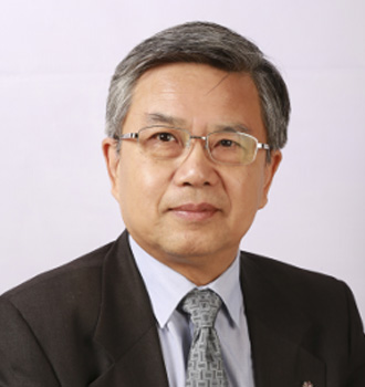
Prof. GONG has been member of the executive council of WFEO since 2009. He has chaired the Committee on Information and Communication (CIC), and the Committee on Engineering for Innovative Technologies (CEIT). He is the Executive Director of the Chinese Institute for New Generation Artificial Intelligence Development Strategies.
10:10-10:25 hrs Plenary 1 – Navigating AEC Industry with digital technologies in Post-COVID era
The pandemic has left significant trail of disruptions across the AEC industry’s supply line and productivity. The industry has met with unprecedented situations in terms of on-site conditions and operational restrictions, which has begun to reshape the entire value-chain of the AEC ecosystem. The need for digitalisation and ConTech solutions has been acknowledged by multi-disciplinary stakeholders in the construction industry.
Technology disruptors like AI, IoT, AR/ VR, Robotic Process Automation (RPA) alongside existing ConTech solutions like geospatial sensors & BIM technologies (Geo-BIM) provide interconnected data flow for monitoring, controlling and analysis of construction site. This facilitates digitised project lifecycle monitoring which is crucial for overcoming the Covid-19 challenges like workplace safety, workflow efficiency and productivity.
In this plenary session, industry leaders will take centre stage sharing their insights on digital solutions rooted in Geo-BIM as the future of AEC industry in COVID and beyond.

Dr Anne Kemp OBE has 30 years of experience and is Fellow and Technical Director for Digital Engineering (DE) and BIM Strategy and Development, at Atkins, part of the SNC Lavalin Group, providing advice to some of the UK’s major infrastructure clients, including Crossrail, Eight2o, HS2 and Heathrow. She has recently been appointed as Digital Co-Lead for the Digital workstream of the Construction Leadership Council. She is one of the ICE’s Invisible Superheroes: Digital Dynamo.
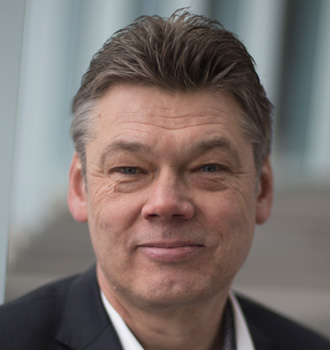
As a Director Digital Construction of Royal BAM Group, Menno is leading BAM to its position as a leader in digital construction in the international construction industry. With over 30 years of experience within the European construction industry, and in construction technology, Menno brings perspectives from both sides of the technology spectrum. Menno has been responsible for IT implementations in the area of CAD, BIM, Lean Construction, Data and Document Management, ERP, HRM, Asset Management and more, and is highly active in European industry standards bodies, such as ENCORD and buildingSMART International.
About presentationThere is an urgent need to transform the way we shape our built environment. Royal BAM Group is taking a leading role in the digital transformation of the international construction industry. We are building the present while we are creating the future. We “make it before we make it.” In other words: we build digitally first, before we build physically. The “Why” part focuses on the needs of the digital transformation for the construction industry, showing that the world of construction is changing. In the second part, the “How” part, Royal BAM Group’s vision and strategy on the digital transformation is entailed. In the final part, the “What” part, actual examples from daily practice in BAM are presented.

Ronan is civil & structural engineer, Project Information Management Professional, BIM (Building Information Management), VDC (Virtual Design and Construction) specialist. He believes that the business benefits provided by a well-planned digital engineering BIM processes will transform the way we design, construct and maintain our infrastructure and buildings. Throughout his career, he has implemented digital solutions and services for large scale developments including airports, hotels, residential complexes, railway stations, educational facilities, exhibition centres, casinos and complex industrial projects all around the world.
11:25-11:30 hrs Break
11:30-12:30 hrs Plenary Session – GEOBIM for Infrastructure Lifecycle Management
Sustainability in building lifecycle management has grown in priority for both building and infrastructure assets. Stakeholders in construction sector have realised the importance of sustainable asset management for economic and ecological benefits. Geo-BIM has risen as the technological solution provider for adjudging life expectancy and replacement costs which design professionals seek of an asset.
Geo-BIM solutions have facilitated crucial functionalities like uninterrupted flow of building information, efficient asset information management, and integrated information of supply logistics which subsequently facilitate smart infrastructure & asset management.
This plenary session will focus on Geo-BIM benefits across various project stages:
- Plan
- Design
- Build
- Operations & Maintenance
- Project Management
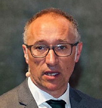
Ignasi has created CAATEEB, the first international European event on BIM, the European BIM Summit. He has also led the National Congress of Advanced Architecture and Rebuild 4.0 construction at its headquarters in Madrid and Barcelona. At the professional level he directs the first e-learning platform in the AECO sector, which is in a crowdfunding process.

Paulus is the director and part of management team of Ballast Nedam Infra Projects. His experience in leading roles – being director, design manager, department head, commercial director – gives him a deep understanding of the business models, primary and secondary processes and organizational model within contractors and design and consultancy firms.
About presentationIn this session we show how we make optimal use of various tools within one tender to arrive at a good offer. Including scans of the existing situation, use of open data as input for the design, link with parametric design, visualization in VR, BIM and/or GIS-3D and the use of 4D models. Be surprised by this modern high-end approach by Ballast Nedam!

Karl Redmond works for the NHS and deals with Strategic Estate and Asset requirements across a range of areas, he also leads/supports work relating to digital and sustainability agendas, utilising skills and experience from a range of sectors, analysing estates data and influencing procurement strategies, finance and strategic priorities. Karl targets the development of a ‘golden thread’ of data, creating tangible measurable outputs within the capital build phase for use during the assets life-cycle, identifying realisable monetary and non-monetary benefits.
About presentationThe talk will explore how initiatives including, BIM process and the ‘golden thread’ of data can provide an answer to some of the core issues being faced by estates e.g. sustainability; optimising asset and resource productivity and performance; importance of digital measurement – “if you can’t measure it you can’t manage or improve it”; holistic thinking ‘starting small, thinking big and scaling fast’; interoperability vs proprietary.

Marzia works as Senior Advisor on Digital Innovation at Mace where she develops and implements digital construction solutions for public and private international clients. She is a member of the BIM Excellence Initiative, Assistant Editor of the BIM Dictionary where she coordinates more than 120 volunteers worldwide, Ambassador of the UK BIM Alliance and Expert at the European Committee for Standardisation (CEN) TC 442 where she chairs a Task Group on information requirements standardisation (Level of Information Need). She is also founder of Italians in Digital Transformation UK. Her team received the best BIM and Digital Initiative of the Year and she has been included in the Digital Champions by Building.
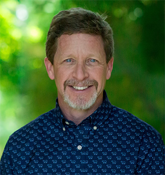
Marc Goldman is the Director of AEC Industry Solutions at Esri. He works with a global team to define and deliver the strategy for Esri’s products and solutions serving architecture, engineering and construction users. Mr. Goldman is one of the leading experts in Building Information Modeling (BIM) and its impact on the processes and business of the building design and construction industry.
Marc studied Architecture and Civil Engineering at Tulane University. He lives in Littleton Colorado with his wife, Lynne a Veterinarian, his two kids and way too many animals.
About presentationAEC firms succeed when they use repeatable and billable processes which lead to higher-quality projects improving our built and natural world. Their success requires a growing number of digital processes, but the end result is almost always a physical deliverable. This session will present business drivers which assists in closing the gap between the digital representation and physical projects. Specific examples will be shown where GIS and BIM are used together to help AEC firms and clients increase their ability to observe, analyze and take action more quickly.
12:30-13:00 hrs Networking and Lunch break
13:00-14:00 hrs Innovating the Built Environment with Digital Twins
Advancements in 4IR technologies including Internet of Things (IoT), big data analytics, AI, along with iBIM creates Digital Twins, Digital replica of cities in the form of a virtual model has been pioneered thanks to the advent of digital twin technologies. Digital twins of cities & built infrastructure enable city authorities and development agencies to simulate various real life scenarios based on changes over infrastructure longevity, implementation of development control regulations, and surge in demography/ inbound migration to name a few. Urban development has been traditionally plagued by shortcomings in inter-departmental collaborations and planning in-silos, digital twin has emerged as a viable solution to overcome these challenges with governance based on digital analysis.
Session focus areas:
- Digital Twins for addressing the urbanisation challenges
- Case studies on successful city digital twin evolution
- Accelerators for geospatial-BIM integration to foster digital twins

From origin a city planner, Roland has a fascination for the phenomena ‘city’, as well from historic as future perspective. The constant dynamics between people and their physical surroundings as a basis for how cities evolve is from both perspectives a very interesting R&D topic. Roland has also a great interest in data and ‘digital,’ that already started during his university period by working with geographic information systems (GIS). And during his working career both topics became more and more integrated, and that finally cumulated in the 5-year program ‘Digital City Rotterdam’, of which he is the program manager.
About presentationRotterdam is trying to think about the ‘next city’, a city in which not only the dynamics between the ‘traditional’ social and physical reality determine the shaping of a city, but also the new digital reality. This digital reality is much more than a ‘new thing’ coming along that needs to be fit in our traditional thinking of the city, or just an instrument that we can use. It is an autonomous reality in which more and more decisions are being made that influence our ‘traditional’ city, but that we cannot influence. We think that after creating a 3D Digital Twin, we want to grow further towards a real ‘urban digital community’. This means that we not only want to connect to the physical reality, but also to the social reality. And then we have created the bases for really becoming a smart(er) city, when we succeed in not only connecting this three realities, but also strengthening and optimizing each other.

Lieven is an internationally recognised Smart City expert at Information Flanders with responsibility for driving transformational change in Government. His deep knowledge of how technology and open data helps pioneer new opportunities to improve the lives of citizens, combined with a first-hand understanding of how co-creation can unlock innovation, enables him to successfully coordinate several EU research projects. Lieven currently leads the high profile Digital Urban European Twins (DUET) project, which aims to create digital twins for more open and collaborative urban decisions.
About presentationDUET (Digital Urban European Twins) is an innovation initiative with the aim to help public sector decision-making become more democratic and effective, both in the short and long term, through the development and use of Digital Twins for policy impact exploration and experimentation in entire cities and regions. Lieven will discuss how these digital replicas of a cities system will (a) enhance day-to-day city management by helping city managers react quickly to real-time events through rapid experimentation of different decision impacts, and (b) ensure longer term policy decisions are more effective and trusted by enabling city managers from different units, citizens and businesses to explore the issues in a visual, easy-to-digest way via a common view. Thanks to the Digital Twins, authorities will for the first time, harness the collective intelligence of citizens to tackle complex societal problems that affect everyday lives.
13:00-14:00 hrs
Workshop: GIS and BIM Integration
Organized by

The convergence of traditional AEC data and applications with GIS has opened the door for architects, engineers and construction professionals to put new productive workflows in place. Using customer projects and in-house examples four of Esri’s AEC industry leaders discuss the importance of BIM and GIS in infrastructure projects. Join this session to hear how the integrations are helping bridge the gap between digital and physical for planning, reality capture and project delivery.
Presenters:

Director of AEC Industry Solutions, Esri
Senior Consultant – AEC, Esri

Imagery Solutions Architect, Esri
Technology Director for AEC, Esri
14:00-15:00 hrs
Workshop: Data standards interoperability and integration: Shaping the future
of digital built environments
Programme Partner

The unparalleled ability of “geospatial” to function as the organizing principle - as the enabler for contextualising diverse data and information. Geo and BIM integration sits at the heart of the Integrated Digital Built Environment (IDBE) decision making. Building Information Modelling is intrinsically geospatial - related to earth - and always within the urban context. The (Urban) Digital Twin is the organising principle for integration physical and human, including social geography that would not function with standards. In this session, you will hear from OGC's communities of practice on "Geo and BIM integration for urban practitioners: Why standards matter” and the "Practical implication the geographically-anchored pose linking together BIM, Geo, AV and VR”. Join this interactive discussion and learn the latest from the IDBE & GeoPose working group.
14:00-15:00 hrs Automation, Mechanisation & Off-Site Construction: DfMA
Technology advancements in construction are spawning new practices that are transforming construction with improved productivity and quality. The advent of DfMA has pioneered automation and enhanced productivity in the manufacturing industry, since then DfMA has emerged as a design philosophy and sustainable methodology for other industries. DfMA can facilitate greater offsite manufacturing while minimising onsite construction, delivering resource and cost efficiencies without hampering planned design vision or compromising on quality. The collaborative environment required and facilitated by BIM is well suited to the needs of pre-fabrication in terms of early coordination and three-dimensional design information. DfMA requires a common language of workflow to integrate relevant geographic information (GIS) with BIM, putting Geo-BIM solutions at the heart of DfMA.
This session will present case studies on implementation of DfMA and ensuring a greater degree of rationalization and integration.

Jaimie joined Bryden Wood – an integrated practice of architects, analysts, engineers, creative technologists and industrial designers – shortly after its formation in 1995. Jaimie leads the application of systems to the delivery and operation of high performing assets. This includes design for manufacture and assembly (DfMA) solutions and new data-led, digital workflows for government and private sector clients in the UK, US, Europe and Asia. Jaimie was the co-author of the benchmark strategy documents, ‘Delivery Platforms for Government Assets’, and ‘Platforms: Bridging the gap between construction + manufacturing’. These have been adopted as a foundation for the UK Government’s initiative to create a more productive, value-driven construction sector.
About presentationConstruction is the last sector, after agriculture, manufacturing and mining, that continues to throw thousands of people at a problem, working with chronically low productivity in physically and mentally challenging conditions. The shift to digital design is accelerating thanks to sophisticated, data-driven tools that go beyond BIM. Algorithmic simulation, machine learning and generative design vastly accelerate the process. Better still, they generate far more possible solutions, which means better outcomes. Meanwhile, new forms of construction are harnessing the benefits of manufacturing. Construction 'Platforms' combine design, manufacture, and procurement principles holistically to ensure a greater degree of rationalization and integration. Manufactured components can be used across sectors creating high, constant demand and economies of scale.
Nick Milestone is Senior Vice President for the US Softwood Lumber Board and consultant to Katerra Inc, North America and is currently Project Director on the world’s largest Mass Timber Project in Singapore. Nick has been in the construction industry since 1986, starting off as a trainee quantity surveyor progressing through to senior quantity surveyor / construction manager / Managing Director. The learnings and innovations gathered from 34 years’ experience in the UK ‘off-site’ construction industry have helped develop a successful mass timber structures business utilizing the key components of steel, glulam, cross laminated timber, structural timber cassettes and light gauge steel framing technology for the residential, education, leisure, commercial and retail markets delivering over 350 landmark projects for Blue Chip Clients.
Paul is an innovative thinker in the area of offsite manufacture and construction of all types of buildings. His experience within the construction products and offsite sector spans 29 years. He set-up Swan Housing Groups innovative factory capable of producing 500 customisable modular homes a year from CLT. Swan are a true vertically integrated developer taking projects from land acquisition through to long term ownership. Paul was involved in all aspects of this set-up and process. He then moved to Ashley House group to oversee all aspects of their modular construction. Since leaving Ashley House Paul has been working as a consultant on a number of high-profile modular projects. His unique outlook and end to end experience, of the process, allow him to provide best in class solutions to his clients.
15:00-1600 hrs GEOBIM 2020 Awards
10:00-10:10 hrs Welcome to Day 2
10:10-10:25 hrs Keynote Address

Richard joined buildingSMART International as CEO in 2013 to lead the professionalisation of the origination and its world-wide activities. Under his leadership buildingSMART has grown substantially, published new standards for infrastructure domains and has a robust modernisation plan to sustain its standards and central role to ensure data flexibility and freedom in the digital future for built assets industry. Richard’s substantial prior career focussed on performance improvement challenges for clients or contractors involved in the procurement and operation of high value physical assets.
About presentationRichard will talk about the strategic importance of open data standards to support full realisation of the economic gains available to the built asset industry from the full exploitation of digital ways of working and digital twins bridging BIM and GIS ecosystems. Richard will emphasise the importance of solid foundations to enable the industry to fully exploit the benefits of new and emerging tech. He will stress the crucial importance of asset and data owners in leading the digital revolution
10:25-11:25 hrs ConTech & Data-Driven Productivity for Construction
The foray of 4IR into the construction industry is gradually changing how infrastructure, real estate and other built assets are designed, constructed, operated and maintained. According to World Economic Forum, full-scale digitization through technologies including wireless monitoring and connected equipment, big data and predictive analysis, cloud and real time collaboration, augmented reality and visualisation, autonomous construction, etc could help the construction industry escape its decades-long stagnation and generate an estimated 12-20% in annual cost savings, equal to between $1 trillion and $1.7 trillion. This session will focus on cases of 4IR adoption and data driven management in the construction processes to enhance productivity.

Paul has an extensive knowledge and understanding of Built Environment, BIM, Virtual Design Construction, Lean Construction strategies, data interoperability, AI, blockchain, construction design, management & advice, modern methods of constructions, manufacturing processes including industry 4.0, renewable energy technologies & energy performance of existing and new dwellings as well as planning regulations. Paul is a BREEAM Accredited Professional, BIM Level 2 Certified Practitioner (Project Information and Task Information manager), and a chartered member of the CIOB. Paul has been a Chairman of Construction Products Europe Digitalization & BIM Task Group, a Chairman of BIM4M2 and a vice-chair of BIM4Housing, a member of Built Environment Executive at the Institute of Engineering & Technology.
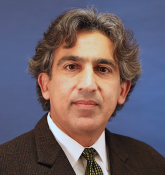
Kourosh Langari has 30 years of experience in A&E infrastructure planning and design with focus on integration of engineering/survey/GIS software applications (i.e. Autodesk, Bentley & Esri).
About presentationCalifornia DOT is utilizing an Integrated Project Delivery (IPD) workflow and a BIM / CIM approach for horizontal BIM infrastructure projects, implementing Virtual Design Construction (VDC) from conceptualization through implementation to optimize the project development workflow.
11:25-11:30 hrs Break
11:30-12:30 hrs
Workshop: Build Back Better Cities with GEOBIM Technologies
Organised by

With the recent COVID-19 pandemic, discussions arose if the pandemic might be pushing folks out of the cities. Contrary to this, according to the U.N., about 60% of the global population will be in cities by 2030. The cities’ infrastructure is already under a lot of stress, and the recent COVID-19 pandemic has further challenged the health and financial systems. Simultaneously, the high occurrences of calamities, associated climate change risks, and the exposure of urban cities to disasters are necessitating governments and communities all over the world to rethink their long-term strategies. Sustainable Development Goal (SDG) 9 emphasizes ‘building resilient infrastructure to provide sustainable industrialization and foster innovation.’ Resilient and sustainable infrastructure is the key to meeting the future generation's requirements and re-build the aging infrastructure exposed to global risks and natural catastrophes.
In the summer of 2020, United Nations Global Geospatial Information Management (UN-GGIM), the World Federation of Engineering Organizations (WFEO), and the World Geospatial Industry Council (WGIC) published a joint white paper. It highlights the value of integrated geospatial and BIM solutions for resilient infrastructure.
WGIC welcomes you to a virtual workshop that discusses this and more joint work by the UN-GGIM, WFEO, and WGIC. We will focus on the need for resilient infrastructure for cities and building and re-building better cities with GeoBIM technologies.
Session 1: Opening session - 40 minutes
Topic & Speakers:
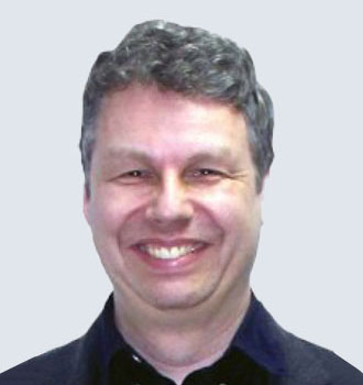
The work of WGIC on AEC and Smart Cities
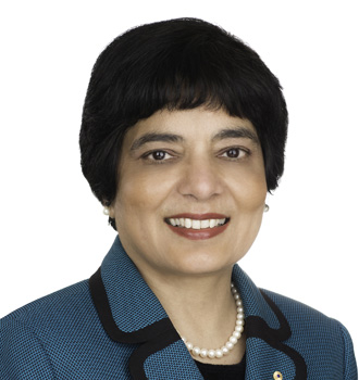
The collaboration between WFEO, UN-GGIM and WGIC (video message)
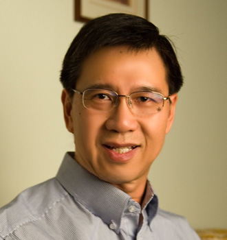
Resilient cities and the relevance of geospatial technologies

Integrated GEOBIM for resilient infrastructure (with a focus on cities)
Session 2: Panel Discussions. Building and Re-building Better Cities
with GEOBIM technologies – 20 minutes
Topic & Speakers:
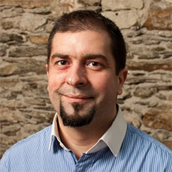
Director of Product Management - Reality Modeling - Bentley Systems, France
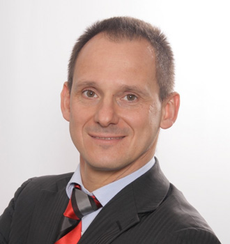
Senior Director new products, BIM & innovation for Oracle Construction and Engineering
11:30-12:30 hrs Unlocking Opportunities with Reality Capture
Digital reality capture is nothing less than a boon for the construction industry with traditionally laborious and not-always-effective capturing of existing field conditions. Traditional methods can lead to inaccuracy and inconsistency of data, and missing out complex details. The reality capture process where an object, building, or site is scanned using static, mobile, and aerial laser scanning and a digital 3D model representation created, offers immense benefits to the design and construction industry. The 3D model allows decision making on real world data leading to project efficiencies, avoid costly reworks, catch potential mistakes before they assume epic proportions, detect challenges and site conditions that can affect a project; assess how various environmental factors might affect the structure of your building, tally site progress with the original design, and so on. This session will focus on applications of reality capture in various projects and technology advancements in reality capture.

Carla is editor of SPAR 3D, AEC Next and Geo Week News, which highlight relevant news and information for 3D-scanning, visualization, AEC technology and geospatial technologies.
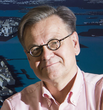
Jarmo Suomisto is the manager of Helsinki 3D+ and responsible of creating, maintaining and delivering virtual models over the whole city. 3D+ also integrates new technology and workflows to processes and city services. 3D+ is 2020 and 2016 Year in Infrastructure Award Winner and 2019 London Tech Fest Main Award Winner. He has been working over 25 years with 3D and GIS in building design and city planning Jarmo has practical understanding of the great potential in 3D. Jarmo is Architect and M.Sc (Civ.Eng) from Helsinki University of Technology.

Paulus is the director and part of management team of Ballast Nedam Infra Projects. His experience in leading roles – being director, design manager, department head, commercial director – gives him a deep understanding of the business models, primary and secondary processes and organizational model within contractors and design and consultancy firms.
12:30-13:00 hrs Networking and Lunch break
13:00-14:00 hrs Integrated GEOBIM Workflow for Surface Transport Infrastructure Development
Geo-BIM solutions are rapidly changing how we build the road and rail infrastructure. The construction of road and railways requires stakeholders to operate at a more sophisticated level of Geo-BIM maturity. Contractors operating in the road and railway sectors, need to deploy world class and innovative solutions for smart road infrastructure development. Geospatial technologies such as LiDAR, GPR, Reality Capture, GNSS-enabled machine control systems, are few of the technologies which can significantly transform the construction of roads and railway sector. As Europe witnesses’ significant investments in this sector, productivity, cost efficiency and safety will be paramount. This session will examine the advancements in project development across various stages of surface transport systems.
Focus areas:
- Drones, and Mobile Mapping Solutions for Road/Rail Construction
- GEO-BIM opportunities for intermodal transportation
- Positioning Infrastructure (GPS-enabled machine control solutions) for Road/Rail design and construction

Dr. Thomas Groeninger is the Head of Division Digital Object Survey and UAV at STRABAG. His current responsibilities includes managing the business unit, developing strategic focus for the development of the division, personnel management, and integration of digitalization. Thomas is an expert in development and implementation of new business models based on completed innovations.
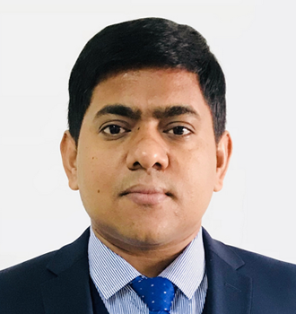
Pramod Kumar Gupta has over 15 years’ experience in highway design, CAD applications development and BIM applications of a large scope of road and urban infrastructure projects. He is currently based in China where he has been working as Deputy Director and Chief Engineer of BIM Center for China Communications Construction Company (CCCC)FHCC, He mainly responsible for his company BIM strategies development plan, managing and delivering the BIM applications to Client and related stoke holders, His Project won the Year in Infrastructure awards in 2017, YII finalists in 2019 and many Chinese BIM Competitions. He is also a key member of China RoadBIM standard team.
About presentationThe presentation will introduce the improvement of highway design method to solve the design and BIM application requirements and digital delivery to meet the uses of digital construction and maintenance by using the digital twin’s technology. The presentation also includes the related software development contents, BIM model structure and attributes implementation.

Jussi is an experienced BIM Production Manager with a history of working in the field of civil engineering as a railway track engineer and BIM Coordinator. Working currently with development of BIM-based construction and as a team foreman for BIM and surveying professionals. He is skilled in BIM-based engineering and construction workflows and related technologies.

George is a Senior GIS Data Specialist at STRABAG AG-UK. He has been researching the benefits of BIM-GIS integration since 2014 and is a PhD Candidate at University College London (UCL) delving into the BIM-GIS integration for Asset Management within AECOO. He currently works on the HS2 Main Works Civil Contract as part of the Skanska-Costain-STRABAG Joint Venture (SCS JV) as the Asset Information Lead. George has a particular interest in developing and implementing solutions founded on GIS-BIM integration to enhance productivity, increase efficiency and improve decision-making across lifecycle, whilst being applicable in numerous application fields and disciplines, such as Construction Teams, Health & Safety, Utilities and Engineering Survey.
About presentationInfrastructure projects are often characterized by the formation of multi-disciplinary teams, consisting of professionals that need to collaborate efficiently and effectively for a successful project delivery. These teams produce streams of information that eventually need to be communicated and shared across the whole project; however data interoperability and the silos within AECOO constitute the exchange of information a significant challenge. The purpose of this presentation is to showcase how the generation of an integrated GIS-BIM environment and the GeoBIM concept can assist on improving the communication and collaboration within a construction project. Bringing together these two domains, creates the foundation of a digital environment that can host numerous data sources created by different disciplines, combine Geodesign with Engineering Design and eventually empower the end user on unlocking the full potential of geospatial data.
13:00-14:00 hrs BIM for Lean Construction
For a sector beleaguered with low productivity and high wastage, going lean is the need of the hour. Lean construction, or designing production systems in a way to decrease time, effort, and a waste of materials, helps maximize value and minimize costs involved during various stages of construction including project maintenance, design, planning, and execution. The collaborative and visualisation ability of BIM adds to improving the total profitability of the project and reduce waste by eliminating components that do not add up in the final product. This session will delve deeper into integrating BIM for lean construction, and case studies on applying Lean principals on construction projects.
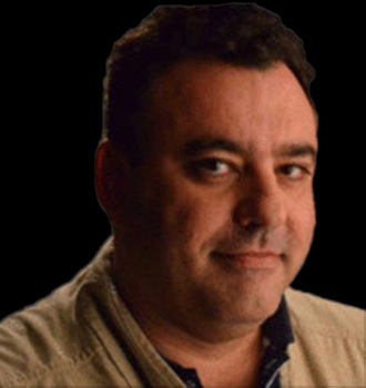
Alexandre Soares has extensive professional experience in Civil Construction, Metal-Mechanical Industry and Engineering To Order (ETO), with contracts in Brazil, Latin America and Africa. He has conducted the management of metal construction, prefabricated concrete and shipbuilding factories, through philosophy of Lean Manufacturing and Lean Construction using various tools such as: kaizens, Kanban, and has led the implementation of lean Design and concurrent engineering projects,
About presentationIn this presentation, we will present the management of drawing preparation using the Last Planner methodology, through collaborative planning, using BIM and its results of adding value, reducing losses and improving productivity at the construction site.

Victor is actively involved in transformation of the construction sector built on the introduction of the Lean construction and BIM principles. He is a member of the Commission “Building the Future”, initiative launched by ITeC, with the aim to introduce Lean thinking principles, BIM methodology and collaborative contracts on the Construction Industry; member of the steering committee of “Lean Barcelona by ITeC”, a core member of BIMe Initiative, a not-for-profit effort based on the BIM Excellence approach and unique research-based approach to digital innovation in the construction industry, and an advisor to public and private organisations.

A Lecturer and Contract Project Manager with over 20 years’ experience in Designing, Planning and Implementation Projects delivered with BIM and Lean Management principles. David’s research interests and continual learning focus is on Building Information Modelling (BIM), and improving the sustainability of the construction industry through lean construction and material science. David has extensive experience of working in multi-disciplinary teams and key stakeholders, with programmes and projects achieving awards for Environmental Best Practices, Innovative Design, Construction and Considerate Construction practices.
14:00-15:00 hrs Mapping the subsurface utility network with Geotech
Subsurface utility engineering is increasingly being recognized as an essential component of construction project budgets. Proper subsurface utility data collection and its management is imperative for construction projects to have minimum time and cost overruns. Availability of reliable subsurface utility data in the planning stage of project’s lifecycle not only ensures robust designing of the infrastructure to be built but also reduces certainty of utility strikes during construction phase.
The one and a half hour subsurface utility mapping session will bring end-users, technology producers and service providers to discuss the various technologies, their adoption, policy environment, etc., in understanding what lies beneath.
Focus areas:
- Innovations in subsurface utility mapping technology (inclusive of GPR, EML)
- Subsurface Utility Engineering policy and standards
- Challenges of technology and services providers in utility infrastructure mapping
- Return on Investments in conducting SUE
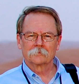
Geoff tracks the contribution of geospatial technology to the digitalization of the construction and energy industries on his Between The Poles blog and other media. His area of special focus is locating, mapping and sharing information about underground utility infrastructure. In recognition of his efforts to increase the awareness of geospatial data and technologies in utilities and construction, Geoff received the Geospatial Ambassador Award at Geospatial World Forum 2014 in Geneva, Switzerland. He is a member of the Singapore Digital Underground Advisory Board. He actively supports open standards as a director of the Open Geospatial Consortium.
About presentationConstruction productivity has been stagnant or even decreasing in many of the world's advanced economies. Underground utilities are an important contributor to low construction productivity as well as being responsible for chronic delays and budget overruns on major civil construction projects. In many parts of the world margins for construction contractors are low compared to other industries. If the risk of liabilities, unforeseen delays, and extra costs resulting from damage to undergroundd infrastructure can be reduced, costs can be reduced resulting in improved margins for contractors and a healthier construction industry. In this presentation measures that government, regulators, and network operators have and are undertaking to reduce the risk of damage to underground infrastructure will be discussed.
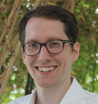
Rob van Son connects policy, people, processes, and technology through research and digital innovation to foster positive impact and change. He currently leads the Digital Underground project, a collaboration between Singapore Land Authority and the Singapore-ETH Centre – ETH Zürich’s only overseas research institution. In this role, he is responsible for coordinating a myriad of research activities aimed at establishing a reliable map of underground utilities in Singapore. Firmly believing that a “whole ecosystem approach” is vital to achieving this goal, he co-founded Digital Underground Connect, a platform for community engagement and knowledge sharing on the exciting topic of underground digital twins.
About presentation
In his talk, Rob will:
- Make a case for reliable information on subsurface utilities to support
the administration, planning and development of underground space in
land-scarce cities such as Singapore
- Reflect on some of the biggest challenges that need to be addressed in
order to establish accurate information on the location of subsurface
utilities
-Argue why a long-term, integrated approach to mapping subsurface utilities
is needed to address these challenges
- Describe how reliable digital data workflows for newly built and existing
utilities can assure and continuously improve the quality of
available information.
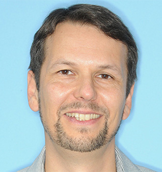
Carsten Rönsdorf is Strategic Proposition Manager at Ordnance Survey and is currently leading the delivery of the North-East Underground Asset Register Pilot on behalf of the Geospatial Commission. He chairs the international working groups for ‘Integrated Digital Built Environment’, ‘Model for Underground Data Definition and Integration’, ‘3D Information Management’ and ‘CityGML’ at the Open Geospatial Consortium.
About presentationThe presentation will report on recent progress in sub-surface data integration and related data standardisation work.
Rob has over 20 years of construction, land surveying, GIS systems management and engineering experience. He is currently located at CDOT headquarters Project Support Unit, Railroad/Utilities Program Manager in Denver, Colorado. He is responsible for improving CDOT’s SUM (subsurface utility mapping) program and utility data management systems overall.
About presentationWhat Lies Beneath: Rob will discuss how Colorado Revised Statue (C.R.S.) 9-1.5-101 (Subsurface Utility Mapping Law) impacts management of utility data within State Highway Right of Ways, and how new SUM technology is working for CDOT’s utility program and the importance of good utility as-built data on infrastructure installed within the State's Right of Way.
14:00-15:00 hrs Panel: GEOBIM Maturity Model
Integrated geospatial and BIM (GEOBIM) solutions are gradually becoming an ‘accepted’ definition across the construction lifecycle. As digital construction becomes the new normal, there is a consensus on treating Geo-BIM solutions to improve productivity across construction processes. Understanding the value-proposition of Geo-BIM solutions has become crucial to application of optimal solutions, there has been an increasing need to have a strategic tool for critically assessing and evaluating the ability of an AEC firm to operate in a collaborative and connected data environment and employ advanced technologies in their workflows.
Geo-BIM Maturity Model, developed by Geospatial Media & Communications in its Geo-BIM Market in AEC Industry report, is a coherent approach to map Geo-BIM integration and use across the construction lifecycle.
The maturity model which ranges from Level 0 to Level 3 and beyond, the model takes the construction technology ecosystem into account and derives mainstream application of Geo-BIM solutions across the value-chain of the industry.
The Maturity Model can help AEC firms to recognize the value proposition of deploying Geo-BIM solutions in the construction lifecycle and the need to transition from Level 2 to Level 3, i.e. from being a mature user of Geo-BIM solutions to a more sophisticated user. Also, policymakers can facilitate a strategic role in mandating the use of Geo-BIM solutions across infrastructure projects and position their countries infrastructure to gain a competitive edge in the market to subsequently reach economic empowerment.
Having developed the first iteration of Geo-BIM maturity model, Geospatial Media, is initiating discussions on advancement of the model. The Roundtable Geo-BIM Maturity Model 2.0, at Geo-BIM 2020, will assess the current deployment of the maturity model and how to advance it across the transport, building and industrial sectors.

Dr. Amarnath Chegu Badrinath is a Subject matter expert, founder, President, advisor, researcher, professor, author & coach. He is the Founding President of the National BIM Society - India Building Information Modelling Association ® that focus on Digital Transformation of Indian AECO Sector. He is serving as Head – BIM Strategy at Larsen & Toubro Construction. He is an Advisory Member for EU BIM Observatory and BIMCrew.

Francesca is postdoc researcher in the 3D geoinformation group at the Delft University of Technology. She is working towards the integration of multi-source spatial data, in particular, detailed 3D information systems(from survey or from design), in interoperable 3D maps, having semantics from open standards and correct geometry. The aim is the concrete employment of such technology for urban applications, such as the digitalization of building permit issuing (she is among the founders and leaders of the EUnet4DBP).

Marc Goldman is the Director of AEC Industry Solutions at Esri. He works with a global team to define and deliver the strategy for Esri’s products and solutions serving architecture, engineering and construction users. Mr. Goldman is one of the leading experts in Building Information Modeling (BIM) and its impact on the processes and business of the building design and construction industry.
Marc studied Architecture and Civil Engineering at Tulane University. He lives in Littleton Colorado with his wife, Lynne a Veterinarian, his two kids and way too many animals.
15:00-15:30 hrs Lightening Talk

Technology Leader and Expert in the Construction industry’s most cutting-edge technologies to streamline projects procurement. With more than 19 years of experience combining architectural, construction, and engineering expertise, in recognition of his pioneering work and vision in Construction Technologies, Amr received the prestigious 2019 Innovator of the Year award at the Autodesk AEC Excellence Awards. Amr leads Windover’s in-house VDC team providing 4D animations, MEP/BIM coordination, laser scanning, drone mapping, virtual and mixed reality, prefabrication, robotics, automation and 3D printing to enhance planning, risk mitigation, scheduling, site logistics, and safety throughout all construction phases. Working collaboratively with clients and project teams, Amr received his master’s Degrees in Architecture from the Boston Architectural College in Boston, MA.
About presentationWith today’s emerging construction and Geospatial technologies—Building Information Modeling (BIM), Reality Capture, Digital Fabrication, and Robotics—the design, construction, and maintenance of facilities is made easier than ever. Construction technologies like these are optimizing facility management and paving the way for even greater innovations within client’s institution walls.
This presentation will explore these construction technologies and how their real-time application makes construction processes a more collaborative and efficient workflow. Examples taken from recent Windover Construction projects will be shared to demonstrate the versatile applications of these technologies. Attendees will leave with a greater understanding of the broad spectrum of technologies and how they can be leveraged during different phases of a construction project to improve effecnices and help build better and safer.